
Chief
Engineer:
“How can I get all CAD, GIS and PDF information for this location before starting a new design?”
All Your Project Data, Maps, Documents and Engineering Drawings in One Place

Chief
Engineer:
“How can I get all CAD, GIS and PDF information for this location before starting a new design?”

Property
Manager:
“Which engineering, maintenance and environmental projects have taken place here over time?”
Contracts
Manager:
“Have we captured and cataloged all relevant documents before we close and pay off this contract?”
Maintenance
Supervisor:
“Where are all the structural engineering as-builts for this location from the 1970s?”
Security
Officer:
“Where can I find all historical gas line information for this incident?”
Connect project information, maps, documents and engineering drawings in one system. No more searching for project data in one file system, engineering drawings in another and specifications and studies in yet another. With Enesgy Documents you can search and access all the information in one software, accessible on your computer or mobile device, even if your project records live in many places. Retrieve project information, project site history, maps, and supporting documents and engineering drawings using text or map searches. And if you are already managing drawings during design and construction using project management software, now you finally have a way to integrate those with historical records and search them when the project is complete.
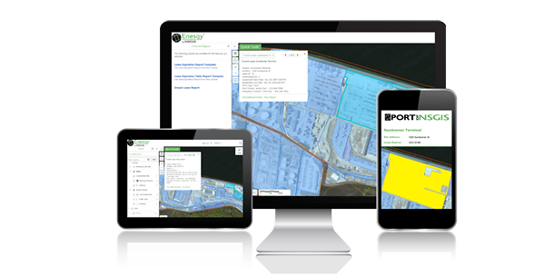
Access your project information anywhere, inside or outside the office. Enesgy can be deployed on-premise or can be cloud-hosted, where there is no hardware to buy and no software to install, move between computers, or back up. Need access to your information while visiting a site, conducting a condition assessment inspection, or while out of the office? No problem, all the information is available via a web interface, no end-user software to install. Want to keep all your information in the cloud? That is fine. Or keep your documents in-house or link to an existing document management system? You can do that as well.
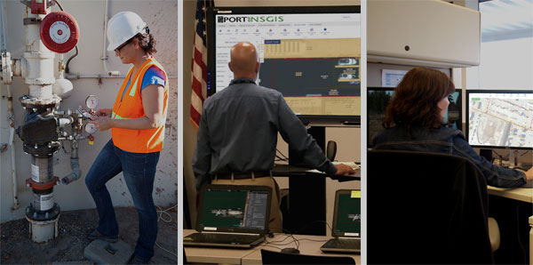
FAQShare project record information more easily with other members of your organization. Engineers can research and download copies of old records prior to starting a new project, while maintenance managers can augment old as-builts with new documents as they make repairs and alter existing assets. Emergency management officers can more easily get the information locked away in old documents that never makes it into digital databases. Whatever your role or needs are, project information can be easily shared across an organization, while adhering to security and permissions policies. Print out customized reports or access the information directly from a map-based viewer. Anywhere, anytime.
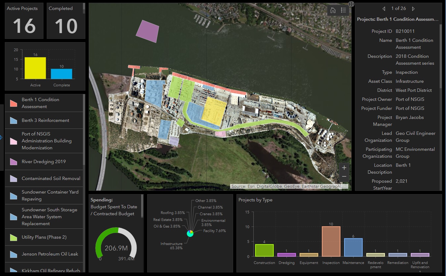
Look at your utilities, boundaries, buildings and other information together with your facilities. The software can leverage an existing GIS database, or help you build one from scratch. This way you can visualize project boundaries and how they have been amended over time, alongside other spatial information. Gather a big picture to see which facility tenants have access to which utilities, on-site security cameras, or how many maintenance requests or security incidents were reported. With the integrative power of GIS you can integrate Enesgy Documents with live data tracking, current and historical asset management data, or environmental compliance information – all on top of facility data and documents.
© 2011-2026 NorthSouth GIS LLC. All rights reserved. Enesgy is a trademark of NorthSouth GIS LLC. Geocortex and VertiGIS are registered trademarks of VertiGIS in the United States and Canada. Essentials is a registered trademark of VertiGIS in the United States. Other companies and products mentioned are trademarks or registered trademarks of their respective owners. Trademarks provided under license from VertiGIS. Esri, Inc.
![]()
![]()